
Third flooding should be less severe on Missouri River
This item is available in full to subscribers.
To continue reading, you will need to either log in to your subscriber account, or purchase a new subscription.
If you are a current print subscriber, you can set up a free website account and connect your subscription to it by clicking here.
If you are a digital subscriber with an active, online-only subscription then you already have an account here. Just reset your password if you've not yet logged in to your account on this new site.
Otherwise, click here to view your options for subscribing.
Please log in to continue |
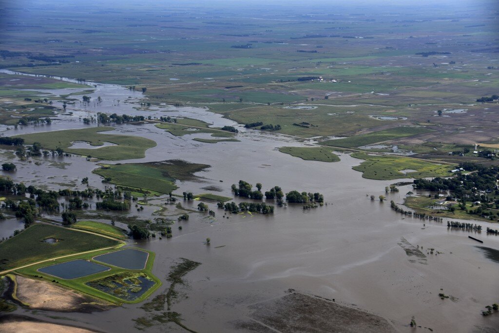
OMAHA, Neb. (AP) — The amount of water flowing down the lower Missouri River this year is approaching the record set during the historic 2011 flood, and another round of flooding is expected this week after unusually heavy rains upstream, federal officials said.
Heavy rains dumped more than four times what is normal in parts of Montana, North and South Dakota and Nebraska last week — triggering flood warnings and forcing the forecast for how much water will flow down the Missouri River to jump by 4 million acre feet (1.22 million meters) to 58.8 million acre feet (17.92 million meters).
That will be second only to 2011’s 61 million acre feet (18.59 million meters), and it means the river has stayed high all year long. Previously, the second highest runoff year was 1997 when 49 million acre feet (14.94 million meters) of water flowed down the river and caused major flooding.
“2019 continues to be a very wet year throughout the basin,” said John Remus with the U.S. Army Corps of Engineers that operates the dams along the Missouri River.
This week’s third round of flooding along the Missouri River will likely be less severe than the first two but still significant, said National Weather Service hydrologist Dave Pearson. When the river crests near Omaha, Nebraska, on Friday and Saturday, parts of Interstates 29 and 80 could again be under water.


